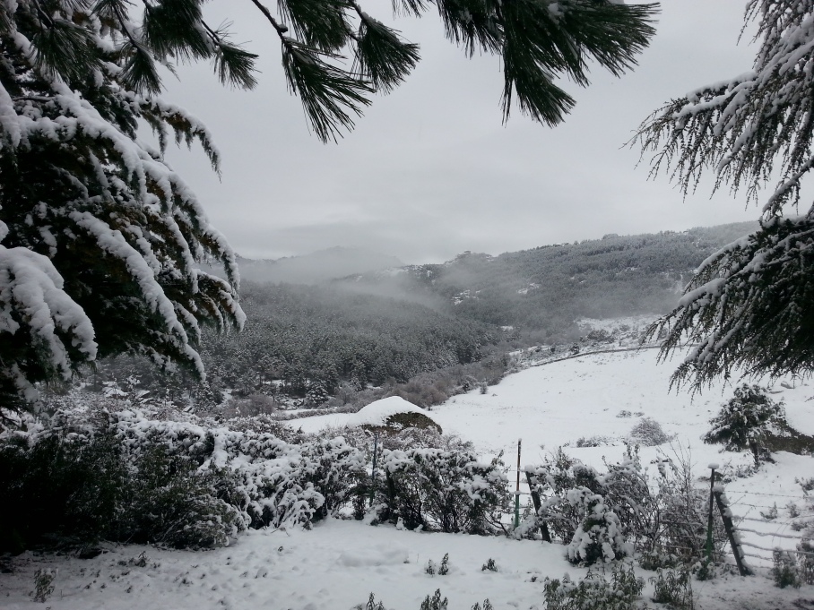
I’ll tell you about the Annapurna circuit and Annapurna Base Camp (ABC) treks soon, but I guess the juicy one was this. By juicy I mean very eventful, full of newbie mistakes which shouldn’t be made, especially when trekking solo and even more so in such a remote area that is the Solukhumbu region. And in winter. In the off season. Good start right? I have since done some research on what trekking agencies say about it, and it’s mostly recommended for experienced trekkers and even mountaineers. In an anti-clockwise direction; though I didn’t choose do it clockwise to make it more difficult, or for Buddhist reasons, it just suited my plans better! But doing it the normal way round offers more reasonable altitude gains and far easier identification of the trail paths!
Now it wasn’t initially in my plans for this trip – I didn’t even know what or where the passes were until I’d heard about them on the Annapurna circuit! But by then a little seed had been sown that I could combine it with going to Everest Base Camp (EBC). And why not!? I’d just come fresh off the 155 mile Annapurna circuit AND ABC trek feeling strong and confident; I was well acclimatised and I knew I was fast. I wanted to make the typical EBC trek exciting and it would set me up perfectly for my planned ascents of Island and Mera peaks (6189m and 6476m) later (this was my first mistake – complacency and a lack of research – we should always respect the mountains). So I got my stuff together and took a flight out to Lukla (rated as one of the most dangerous airports in the world but if you want scare stories feel free to google them yourself). I flew in rather than hiking from Jiri or Shivalaya because I liked the idea of flying in and hiking out, plus I’d get a viewpoint over the Himalaya that you just wouldn’t get by hiking in. It was a great experience, complete with plenty of turbulence from the thermal currents coming off the mountains at 7am. Tip: get a seat on the left!

Flying into Lukla
So I made it to Lukla, arriving at 7.30am (an hour later than scheduled) and stopped somewhere for breakfast. My pack was heavy; the baggage allowance was 10kg check-in plus 6kg carry on. The scales said 20kg which didn’t include my camera, IPad, 1 litre of water and a few miscellaneous bits. On the Annapurna circuit my pack was about 16-17kg but this time I had to carry an ice axe, crampons and basic climbing gear too. It felt heavy, and I felt slow. I wondered about getting a porter at Namche to take the stuff I’d need for the peaks to Chukhung and save me lugging it all the way round but I was too cheap and too involved with my own sense of pride to ‘cheat’, as that’s what it felt like. I stripped everything down to a bare minimum after learning from the Annapurna circuit what I could do away with or compromise on. Now you may say that an IPad was a luxury, and in a way it is, but I have loads on e-books on there and I quite like reading a little after a long day’s trekking.

My pack contents
Anyway, so on day 1 I left Lukla at 8.30am, got to Bengkar by 12pm for lunch (after getting lost twice, already!) and arrived in Namche (18.5km away) by 3pm. It was a good start, apart from getting lost, but on this first day I already sensed that it would be different from the Annapurna circuit (which had signs and painted markings all along the route – you’d have to be trying hard to get lost there). On the way I passed many porters (commonly thought of as Sherpa but are in fact usually Rai people) carrying staggering loads – one was carrying thirteen 4×4″ 3m planks (ignore the use of metric and imperial) on his back and I’ve heard stories that some carry up to 100kg plus, and this is going uphill! It’s difficult to comprehend the life that they live here in the mountains, with no road access only man power to bring everything they need (and everything a tourist might want) up to them. They may just be called porters but I have an immense respect for their strength and the things they do every single day to live up here.
Day 2 – this is the first major calamity. I slept fairly well, and made my way to Thame (9.1km away) in 4 hours. I still felt tired, I wanted to push on up the historic trading route that leads over Nangpa La into Tibet, stopping before the pass at Lumde where I planned to have a rest/acclimatisation day before crossing the first high pass – Renjo la. I didn’t check the map and instead just followed the trail which, 4.5 hours later, had taken me far west towards the forbidden Tashi Labsta la, a high pass into Tibet! It was an incredibly stupid mistake, I’d passed a couple of empty villages on the way and hadn’t thought anything of it as I knew it was off season and a lady at Thame had said that a most villagers would have moved down to Thame for winter. It was only when it started getting late and I looked at the map and compass that I realised I might be in trouble. I was supposed to be heading north but it didn’t look right compared to the map and I was weary of hiking much more when I was close to a village that had, thankfully, a running stream nearby and buildings for shelter. I hadn’t come across anyone since Thame.
My watch has an altimeter built in, it’s not bang on accurate, but it’s a useful tool. Lumde was supposed to be at 4368m and I was at the same altitude, but obviously in totally the wrong place. I turned on my phone and resorted to Google Maps to help pinpoint me, and after a while it revealed my mistake – there was no signal or data but the GPS showed I was way out. So I accepted that I’d have to stay here the night and retrace my steps the next day. I found a German Red Cross tent (which I’m very thankful for and hope they didn’t mind me using it) which I opened and took shelter in for the night. I filled up my water from the stream and had 3 granola bars for dinner, along with a few scoops from a tub of peanut butter I’d wisely decided to take with me. It was a windy night, and I was thankful to be inside a tent, but my thoughts ran away from me. My mind kept drifting to fate and humility and Christopher McCandless (the real life story of Into The Wild) – happiness is better shared. Mountains are my sanctuary, a chance to lose myself in my thoughts, to meditate and make sense of life. I accept the risks I take for the things I do, but felt sorrow to be ‘merely’ trekking if it came to the point of me dying for what I love – rather than true mountaineering or climbing. Sobering thoughts. I always see it as training, character building – pushing the limits of my mental and physical self to see what I’m really capable of, but this seemed a silly and pointless waste of life. I was being dramatic and I knew it, as I’d just have to go back the way I came until I found the turn in the trail, but it was an important lesson to learn for me and I needed to really understand the potential consequences.

Heading back towards Thame
I survived the night, obviously, and with 2 granola bars for breakfast I packed up, left the tent as I found it, and made my way back. I knew where the turning was, I’d looked up at the valley and assumed it to be Gokyo at the time, the valley I’d cross into. It took me 4.5 hours to get to Yilajung, where I stopped for lunch with monks. I ate what they were having, which was dal bhat with yak meat (Tibetan monks have always eaten meat). I’d been meat-free for about a month but I wasn’t willing to ask them to make up a meal especially for me and I secretly felt I needed the protein. I left at 1pm for Lumde, but instead arrived at Arya at 4pm. Once again I hadn’t found my intended destination. I suspect Lumde was not far off, just on a slightly higher plain but the farming family I found had a room and were happy for me to stay. It was really nice actually, I almost felt a distant part of the family – I stayed 2 nights (as it snowed on the first) and on the second I ate with them (meat again) in the kitchen and drank chang (home brewed beer mixed with porridge, mainly to keep warm) the mother kept topping me up until I was drunk! The mother and father were spinning out yak wool (they had 13) while an auntie was knitting blankets. The boy who was only 20 was really mature and responsible, and his brother-in-law was a climbing guide who’d summited Everest three times! But you’d never have imagined it from the simple farmhouse that they had, they were very humble people. I actually felt sad to leave, I hope to go back there in the future and see them again, and I gave them more than what I’d ate and drank from their menu totted up to. Lovely lovely people.

Nangpa Teahouse in Arya
I left at 8am the next day still nervous about finding Renjo la pass (5360m). I picked up a path and found Relama Tsho lake and relaxed a little. I was at 5000m now and it was difficult to breathe – I’d take 30 paces up and then have to stop to catch my breath. Drinking water and walking at the same time was like I was drowning! All was going well…until I lost the path. I was maybe 200m altitude from the ridge and I couldn’t see any more cairns. I tried to make a rational decision and went left; it was scree but it skirted underneath a big expanse of rock which I thought looked solid. It wasn’t. Half way up the scree was falling away beneath my feet, and the rock that I was holding onto was loose and breaking off in my hands. This was not a good situation. I looked around helplessly and then to the right of where I’d branched off I saw a faint trail and a cairn. Another mistake, great! It was too late for me to reverse the moves that got me here, so the best I could do was soldier on and hope that I could traverse at some point back to the right. In my head I had thoughts of Johnny Dawes on Gogarth dealing with choss (loose, crumbly rock) and set my mind that today was not my day to die. I said it to myself out loud when things were falling apart around me and I fought hard to keep my position and even make progress. Eventually I made it to the top of the ridge, I’d say it was a grade 4/5 scramble of maybe E2 boldness and I felt glad to be alive.

Looking back west from (very close to) Renjo La
A.J. Hackett, the founder of bungy jumping said, “Do something every day that makes you feel alive.” That quote kept coming into my head that day, and I thought, “yeh but does it always have to be so committing!?” I was exhausted but the thing was, it wasn’t over. It had taken me 2 hours to get to the top of the ridge which I suspect was less than an hour on the right path but looking over the other side it was steep. Too steep. I traversed the ridge to a gulley right before a high point where there was prayer flags strewn across the rock and decided I wasn’t going to try and solo over it so I had to take the steep scree gully. Again it was all loose, and I was trying to down climb and hold on to what I thought was solid rock as the ground literally slipped away. I don’t mind admitting I shouted out a few times when my feet found themselves on nothing and so my weight transferred onto my hands, which in turn found themselves holding big pieces of rock that were no longer attached to the face. My core was working overtime in tensing up to fling myself at another potential hold while trying to manage the pendulum effect of 22kg on my back. I’m not exaggerating in saying that it was the most intense 3 hours of my life. I eventually got down, and after a few more slips (and cuts) on the scree, a frozen stream/waterfall crossing and some big rocks I made it to Gokyo (4790m, 11.2km away) 8 hours later. I hadn’t seen another soul that day either. Recalling that day even now has my palms sweating.

Looking back to Renjo La from the comfort of Gokyo
I had planned to go up to Gokyo Ri (5360m) for sunrise, but I’d snoozed my alarm several times after the ordeal of the day before, eventually waking up at 6.26am and stumbling out with my camera to get up the 570 metres in a race against the sun to the top. I lost. My blurry eyes and stunned respiratory system were in no mood for an early pre-breakfast ascent and I brought no water to soothe my dry mouth. Still I made it in 1 hour 30 mins, and down in less than an hour to a well deserved Sherpa stew. The rest of the day was supposed to be spent exploring the sacred lakes of the Gokyo valley but I had no energy and so rather than spend a day moping around I decided to do the short trip across the Ngozumba Glacier (longest in the world apparently) to Dragnag (4700m) in preparation for the big day across Cho La pass. It took me 1 hour and 40 mins (3.8km) and wasn’t as intimidating as I thought crossing a glacier on my own would be, but this sort of stuff would be unthinkable in Europe! Once again I saw no one.

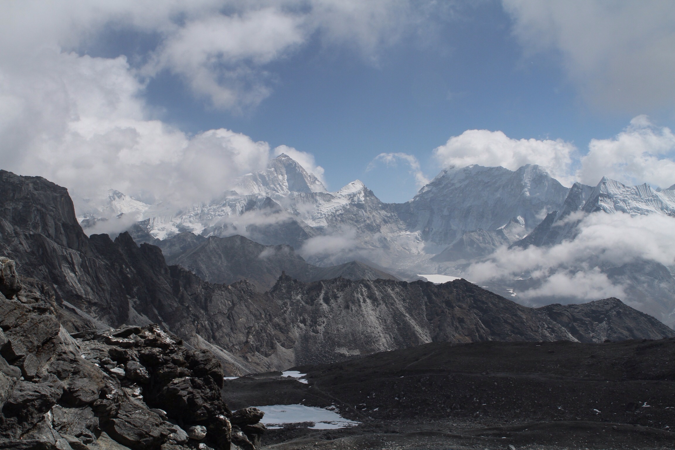
View from top of Gokyo Ri with the Ngozumba glacier and Gokyo second sacred lake. Everest is on the left
So I’m now on day 7 of the trek and it’s the big one, the crossing of Cho La (5420m). I woke up early and left at 7am. Things were going smooth and I got to the flag by 8.30am. On the way I’d bumped into a Spanish guy I’d met in Gokyo who couldn’t find the way and had slept outside the night and was heading back to find an alternative route. He’d said that it was impossible to cross the glacier, and he had crampons with him so I was a little worried. Anyway from the flag I looked at the map, I saw a glacier to the north, and a trail, the only trail, heading that way. Once again I blindly led myself into a trap. I got to a gompa and the base of the glacier. I followed tracks skirting beside it and then put on my big boots and crampons and continued to follow these tracks (which I later found out to be the Spanish guy’s footprints). I felt great, I feel really secure walking in crampons and the sun was shining – I was happy. Then I checked my watch and it said altitude 5788m. I found a dead man anchor for abseiling in the snow, which shouldn’t have been necessary for a trek. I headed north across the glacier and came to a cul de sac of 6000m+ peaks. I returned to the site of the dead man anchor and there was a narrow col above, so I scrambled up to it and found another anchor. On the other side was a steep scree path and I took a few steps down to see another anchor at the bottom. This was not right at all. To the south of me was a peak that was maybe 200m higher if that. I looked and looked and searched the map for answers. My confusion arose because of what others I’d met at Dragnag had said about crossing a glacier. I was way too far north. I was disheartened and so annoyed at myself – how many times can I make the same mistake!? Silly, stupid mistakes! The day had started so well…
So I made my way back and then felt something swinging around on my pack. I realised my usually cinched up pack was missing my small dry bag, which had my down jacket, head torch etc in it! Furious with myself I thought I must not have attached it securely and it bumped off when I was at the scree slope, or north on the glacier. I took my pack off and frantically ran up to the anchor point – it wasn’t there. I started to head north but then as my breathing was trying to catch up, along with my brain, I thought if anything it would be at the narrow col at top of the scree slope which is where I last took my bag off, but it would probably have fallen down and be lost to the glacier forever. But I had to try. I was exhausted now from running around like a headless chicken but in the back of my mind I was already beginning to accept the fact that I hadn’t enough energy to return to Dragnag and would probably end up spending the night outside, like my Spanish friend had, so I really needed that down jacket. I got up there and there was nothing. I was racking my mind for ideas and options. Yet again I was in a bad position, there was no chance of contact and the forbidden thought of calling mountain rescue was pointless as there was no phone reception here, on a glacier, surrounded by big, imposing mountains.
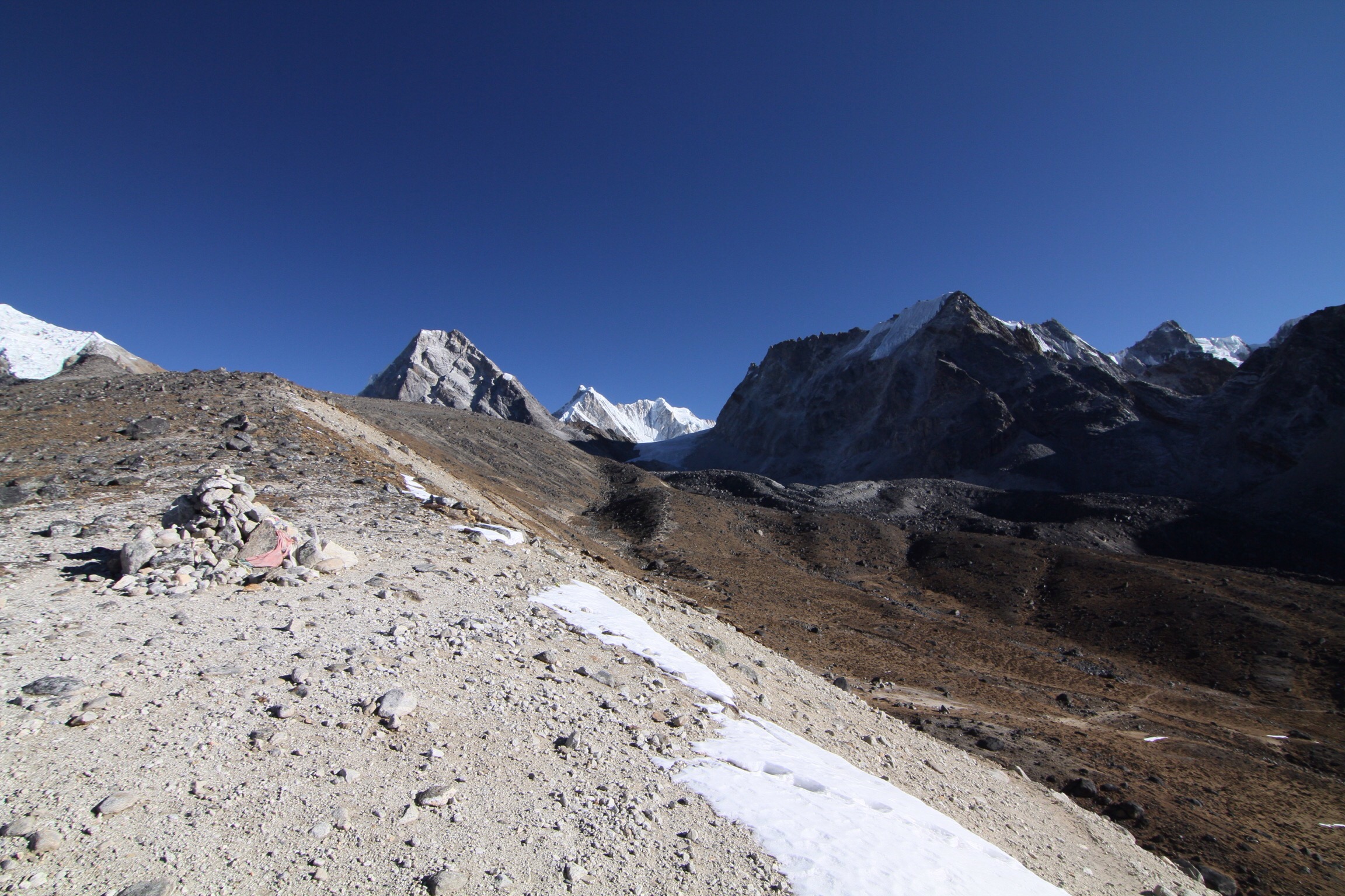
View from the top of a small ridge, with Cho La pass on the right and the glacier i decided to go for in the centre
I got back to my bag then had a thought, is the dry bag inside my pack? I’d repacked things when I put my big boots and crampons on…they took up a lot of space…yes! It was in there all along! I had to laugh to myself, cynically, as I’d just wasted a good half hour or so of daylight and a tonne of energy running up and down and across this glacier that I shouldn’t even be on! So I got off, and back down to the Cho La ‘valley’ and looked around for some big boulders to provide some shelter from the inevitable winds coming up the valley and set up camp. I laid down my stuff at the best spot I could find, which was also by a pool of frozen glacier water that I managed to crack through with my axe, as I’d run out of water an hour earlier. I headed further south to look for the pass, spotting the only real low point of the line of mountains blocking my progress.

Cho La glacier…the wrong one!
It looked possible, slopes of rocks again, and no path visible to my eyes, but it had to be. I tried to look for the red flag I’d passed 8 hours earlier but I couldn’t see it. It felt like it was almost parallel with it…could I have been so stupid? [Don’t think it] I didn’t have the energy to try that night, and I knew from the top of the pass it was 2 hours down and across the right glacier to the nearest village so I headed back to my stuff, laid out my Thermarest and sleeping bag, put on all the clothes I had, and went to filter the sediment-filled glacier water. I managed to do a litre before my fingers went numb (my filter bag was split from the Annapurna circuit). I got into my sleeping bag by 6pm, had dinner which consisted of 2 granola bars (my last) and a couple of spoons of peanut butter. The moon was bright (it was full moon the previous day) and the stars were out, but I was in no mood to take night pictures. The wind was picking up from the south, and my southern boulder was not doing its job. I cinched the sleeping bag as tight as I could and pulled the hood and my buff over my eyes so that only my mouth was exposed. The moisture from each breath froze onto the outside of the sleeping bag, and I had to keep my water bottle inside with me. The thermometer on my watch read minus 10 degrees Celsius (without wind chill). I was wearing an Icebreaker thermal, tshirt, Patagonia Primaloft jacket, North Face Nuptse down jacket 700 fill, thermal boxers, jogging leggings, soft shell pants, socks and down boots inside a silk sleeping bag liner, and a -19degC comfort rated Rab Ascent 900 down bag. I slept on and off all night, and woke up around 6am at first light. My toothpaste had frozen, along with my shoes, pack, and practically everything that wasn’t inside my bag with me. My vision seemed blurry, I think because my tears and eyelashes had frozen. I slowly got my things together and by 7am was heading up towards the notch in the mountain skyline. I was relieved when I found a cairn, and then another (you can’t always tell if a cairn is really a cairn, or a coincidental pile of rocks)! Then I looked back and saw the trail – it was obvious from this side! Maybe that’s why most people do this trek the opposite way round…(it was the same for Renjo la pass)
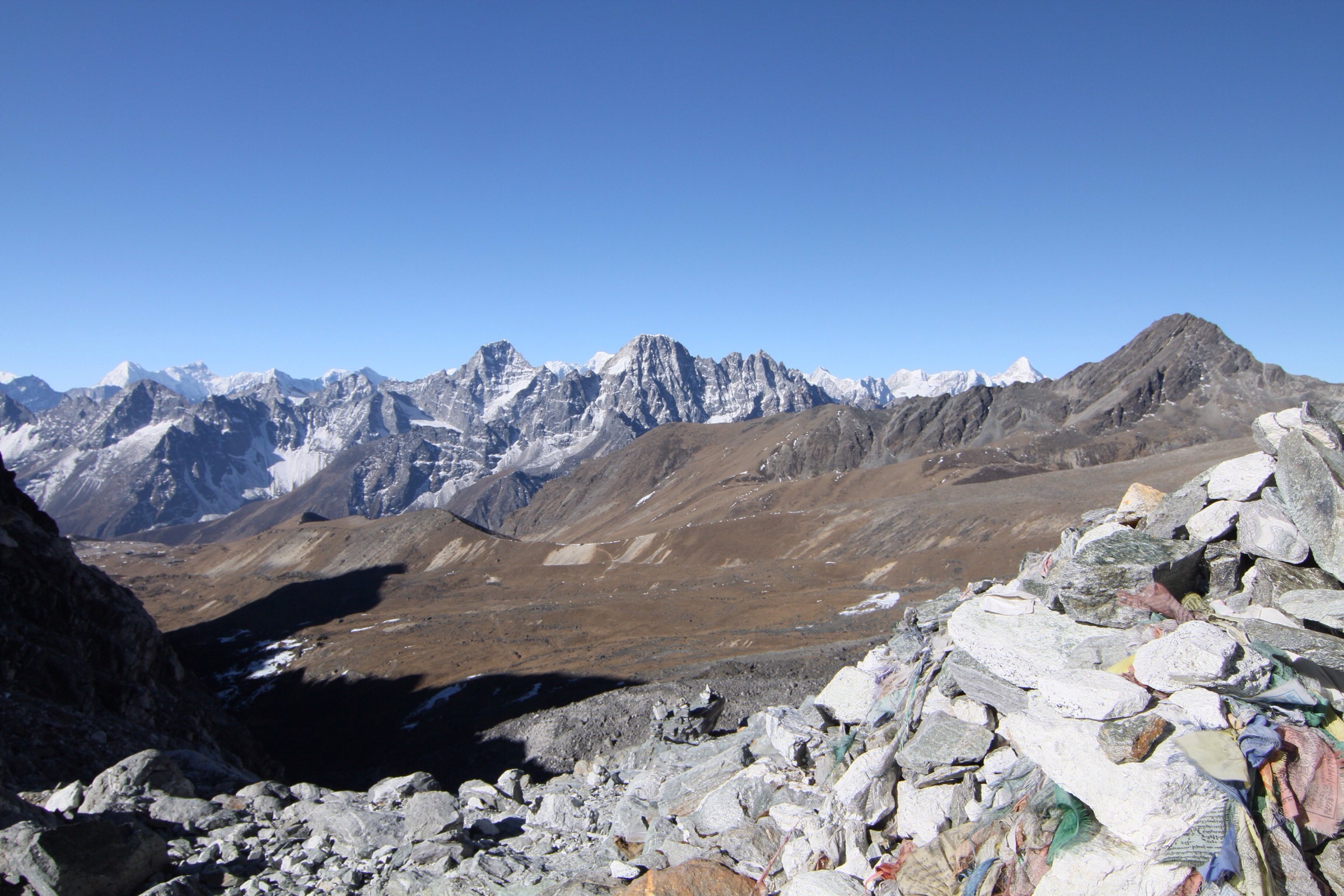
Looking back west from Cho La
I reached the top at 8.30am to prayer flags and the actual glacier I was supposed to be crossing. Relief and happiness to fight another day swept across me. I once again geared up and got onto the glacier. These glaciers aren’t really like the ones you find yourself tackling in Europe. The wind sweeps over them and the sun melts them into glass-like shards so that they’re not flat expanses of snow and ice to simply saunter across but awkward, potentially ankle-twisting undulating terrain to timidly step over and look forward to reaching solid rock again. At this point, I had checked the map several times, then several times again. The map does point out the glacier crossing, and then it says to stay on the left side…from which side of approach!? I knew I was probably wrong but I stayed to my left and did find a path, though there seemed to be a much nicer path on the right (or left if coming anti-clockwise, or looking at the map face on). In any case I got off the glacier, retired the big boots and got into my downhill jog rhythm to reach Dzongla by 11am. In sheer celebratory mood I ordered dal bhat for lunch (2 servings) and a super sugary black tea. While eating I found myself shaking a bit, not sure if it was the sugar hit or pure happiness to have made it. I then left at 12pm with the aim of making Lobuche by 2pm, so I could spend the rest of the afternoon relaxing and recovering. Of course, this being me, I missed the shortcut trail (or maybe convinced myself it wasn’t the right one because I was too tired to go uphill) and ended up in Dughla at 1.30pm instead. Lobuche was still another 2 hours uphill I was told. Ha. Well Lobuche was where I wanted to drop a load of things, taking only the bare essentials up to EBC before returning for the final pass, Kongma La. It ended up only taking me 1.5 hours plus I got to see the tombstones of all the Sherpas who had died. So upon arriving I decided to treat myself with some coconut cookies, and hot bucket shower (I had asked for a free cold bucket as I’ve been having mostly cold showers since I’ve been in Nepal but I’d been misunderstood) and with the rest of the luke warm water I washed some clothes and aired some stuff, ready for the pilgrimage to EBC.

The glacier that you must cross from Cho La – crampons recommended!
Up to EBC was pretty uneventful, thankfully, it took 1 hour 40mins to Gorak Shep but would’ve been shorter had I not taken a zigzag path through the Khumbu glacier. It felt glorious to be wearing a pack that was probably less than 10kg! As I’d arrived by 9.20am I went to Everest Base Camp itself which took about an hour and stood in awe of the giants that surrounded me, practically alone. I had wanted to go down close to the famous Khumbu icefall but tiredness, laziness or feelings of intimidation stopped me and turned me around back to Gorak Shep. My plan for the rest of the day was to catch up on emails (Gorak Shep/EBC is the first time I’ve been able to get online since Namche) and then head up Kala Patthar (5550m) for sunset. I’d been told it takes 2 hours but I made it in 1.5 hours, which was not a good thing this time as it meant I had to sit around freezing for 1.5 hours at -6degC! Unfortunately it wasn’t a clear evening as the clouds from the valleys below rolled in but I did bump into the Spanish guy from before and we had a laugh about Cho La pass! By 6pm I was stiff and frozen so I ran back down to Gorak Shep in 20 minutes and sat by the fire for the rest of the night.

Everest and Nuptse catching the last of the evening light
I had intended on going back up Kala Patthar in the morning to catch sunrise, but sleep evaded me, instead replaced by anxiety of crossing the final pass, summiting Island and Mera Peaks, and other things so that I let myself wake up when I felt like it. The morning seemed overcast anyway so I don’t feel like I missed out on much. Headed back to Lobuche after breakfast and squeezing out all the internet I could, and got back in an hour so had a look at the route over the Khumbu glacier and made sure I knew where I was going the next day. I also had a quick cold bucket shower…which was unpleasant, possibly more so because 2 days ago I’d been spoiled with a warm one in the same bathroom so my body was expecting loveliness but instead got a sharp, muscle-tensing shock to the system.
For some reason I didn’t sleep well that night, lots of things and ideas on my mind. There was a light sprinkling of snow overnight, enough to make your feet slip occasionally but not to cause much trouble. It made the ground sparkle when you looked at it, as if it was covered in diamonds. Anyway I left at 8.10am, took my time across the Khumbu glacier and reached the top of Kongma La (5535m) in 3 hours. Happiness is…when you see the silhouette of cairns and prayer flags on the top of the horizon and the sun decides to show itself when you’re done with going uphill!

Looking up to Kongma La from Lobouche side
I checked the map several times and could see a path for the descent, which actually goes through another pass at 5447m but not sure it was the right way – it was super steep and committing (well, it is me) and then turned into a scree slope. I was definitely following the prints of others, but they may also have made the same mistake. I eventually reached the niyang khola (river) when it started snowing again, sticking slightly. It was a bad descent – my faithful shoes were pretty much devoid of tread and ripped on the sides and edges, causing a lot of slipping moments and lots of stones inside – not fun. At the first sight of Lhangbo I kept left of the river and headed in an easterly direction but mist and clouds were coming in and obscured my view. I kept going but I had to idea how far east I was and was definitely not in the mood to overshoot Chukhung! At last there was a gap in the clouds and I spotted some yak down below, so a settlement must be near. I decided to give up my hard earned altitude and scrambled down to the river, found a house, got directions and made it to Chukhung (4730m) before 3pm. Not a bad day, could have been easier but at least I made it.
So that wraps up my 11 day impeccable example of how not to do the Three High Passes trek! It’s a great experience, and feels much more remote and adventurous than the popular Base Camp treks. Now for me it’s onto Island Peak…